Pemi Loop Trip Report (3 Days, 2 Nights)
I checked the Pemi Loop off my backpacking bucket list in August 2025. I’d wanted to backpack the Pemi Loop ever since I did my first backpacking trip in the Pemigewasset Wilderness as a child to hike Flume, and was ecstatic to finally do the hike. I also was taking one of my close friends on her first trip to the White Mountains. We’re both experienced backpackers, and a lot of my favorite summits on the NH 48 are in the Pemi.
Day 1 (Lincoln Woods -> Guyot Tentsite): 11 miles, 3900 ft of elevation gain
We decided to hike the loop counter clockwise so we could end our hike after an epic traverse of Franconia Ridge rather than on the endless railroad grade between the Bonds and Lincoln Woods. We started our hike bright and early out of Lincoln Woods after a quick stop at Mad River Coffee House for breakfast. We were on trail around 9am, and chugged along the railroad grade towards the Bonds. We took a short detour to Franconia Falls to jump in the water. It was well worth the stop!

We took our lunch break at the base of the Bondcliff trail and filled up our water bottles in the Pemigewasset River. The climb up Bondcliff was relatively steady and not too strenuous despite the hot weather. Unfortunately, we made the mistake of not topping off our water bottles after the first few crossings of Black Brook, and we did run out of water as we climbed up the summit of Bond. Nevertheless, we made it safely to Guyot Tentsite and were able to replenish our water sources from the spring.

We did end up sharing a tent platform with another group, but the tent site wasn’t overly crowded. We were lucky enough to have clear skies at night, and slept with our rainfly off the tent. We were even able to see several shooting stars.
Day 2 (Guyot Tentsite -> Garfield Ridge Tentsite): 6.6 miles, 2200 ft of elevation gain
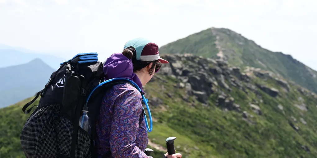
We had a shorter day planned for Day 2, and were able to take our time getting out of camp. We made our way to the Twinway, and took the time to relax and enjoy the summit of South Twin. From there, we headed down to Galehead Hut where we were able to enjoy some chocolate baked goods made by the Hut Croo. After Galehead Hut, we suffered up the steep climb to Garfield Ridge Tentsite. We were able to snag a platform to ourselves, and settled in for another night on the trail.
Day 3 (Garfield Ridge Tentsite -> Lincoln Woods): 14.5 miles, 3500 ft of elevation gain
We woke up early on Day 3 knowing that we had a lot of climbing and miles ahead of us to get back to Lincoln Woods. We cruised over the summit of Garfield, and then descended down towards the start of the climb up Lafayette. The trail between Garfield summit and the start of the Lafayette climb is riddled with PUDs, and we developed an in-depth PUD rating system as we hiked. The climb up Lafayette was brutal, and when we finally arrived on the summit, we were ready to soak in the view and have a snack. The last time I’d been on Lafayette was to finish my 48 in November 2022. At the time, it was below zero and extremely windy. It was nice to be able to fully enjoy the summit!

We enjoyed lunch on the summit of Lincoln, and chatted with some AT thru hikers. Too soon, it was time to head on. We reached the junction for Liberty Springs Tentsite, and quickly debated who should hike down for water. There was a known problem bear in the area, and we decided it was easier if we both went to down Liberty Springs. This ended up being a really good decision, because a thunderstorm ended up rolling in.
We sheltered under a tarp in the “kitchen” area of Liberty Springs, trying to decide whether we camped there for the night, or waited out the storm. We had enough food to stay out another night, but had dreams of burgers and a shower. We decided to wait an hour, and by then, the rain and thunder had subsided. I had hiked down the Osseo Trail at night before, and was confident that we could safely get back to our car. We made it over Flume, down the ladders, and down the steepest switchbacks before sunset.
We turned on our headlamps, and hiked the rest of the way out in the dark. We treated ourselves to a wonderful feast at the nearest fast food restaurant before driving home.
This trip really checked all the boxes for me, and I was glad we ended up going counterclockwise. Coming down Bondcliff and hiking out the railroad grade at the end of the trip would have been a slog. I also think the climb up the Bonds is easier than traversing Franconia Ridge on the first day.
To see the gear I used on this trip, check out my gear list!